Monday, February 28, 2011

Body World Exhibit in Phoenix

Today Teri and I invited Bob and Lori for a trip to Phoenix to see the Body World Exhibit at the Natural History Museum.

I was NOT allowed to take photos so these are from their website:

body onebody7,0body8,0

It was incredible, shocking and gory all at the same time. We all where glad we went.

Friday, February 25, 2011

Hike Club–Packsaddle Loop

Today I went on the Hike Club north-east of Scottsdale.

Some Photos:

P2258927P2258931

Lunch break

P2258944

Wednesday, February 23, 2011

Apache Trail with a side trip “Dolly” on Canyon Lake

Apache Trail map

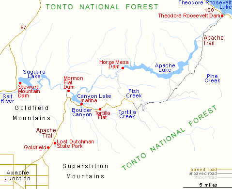
The Apache Trail, or AZ 88 as it is officially known, links Apache Junction at the edge of the Greater Phoenix area with Globe via Theodore Roosevelt Lake, through the Superstition Mountains and the Tonto National Forest; 40 miles of steep, winding and mostly unpaved road past magnificent scenery of twisted igneous mountains with dense forests of saguaro and ferocactus, and several deep blue lakes.PICT0041

An Old sign on highway 88.P2238839

P2238848

The Apache Trail

P2238855


P2238887The “Dolly” on Canyon Lake.P2238219

Some of the views on the Dolly at Canyon Lake.

The end of the Apache Trail is at Roosevelt Dam.

PICT0040

All the lakes are a result of dams on the Salt River as it comes down the Superstition Mountains.

Saturday, February 19, 2011

Palm Creek RV Resort Quilt Club Show

There is a large quilt club in the park. This is an example of some of the displays.

PICT0010PICT0014PICT0025

Friday, February 18, 2011

Hike Club–Saguaro Lake Hike

Today I went with the Hike Club on the Saguaro Lake Hike. Part of the many dams on the Salt River.

Map picture

Map picture

We went for a hike on the north side of Saguaro Lake.

Some of the photos:

Our Group

P2188798

Lunch Break

P2188807P2188815

Fishing.

P2188821

Thursday, February 17, 2011

Doves Nesting

After repeated flushing out the start of a dove nest on the main slide of the motorhome(under the awning). The doves have started a nest at a more appropriate area.

This is the palm tree to the right of our motorhome.

P2178176P2178767

Wednesday, February 16, 2011

Trip to Superior Az. and Roosevelt Dam

Today we did the tourist drive to Roosevelt Dam Via Tonto National Monument.

Map picture

We First stopped in Superior Az., an old mining townP2168709PICT0001

Then we went through a tunnel to this:

P2168718P2168721

Then off to Tonto National Monument(Cliff Dwellings)PICT0013

The Lower Cliff Dwellings

P2168747

PICT0021

The long climb up the trail.

This next photo I took on the way up. Roosevelt Lake is in the background. This photo won the weekly competition at the Photo Club.

P2168740

Roosevelt Bridge

P2168759

Roosevelt Dam

PICT0046

The day was ending so we went straight back to Casa Grande.

Saturday, February 12, 2011

Day Trip to Canyon Lake

Today we left early for a trip up to Canyon Lake.

First Stop

Palm Creek Rv Park to the Dairy Barn

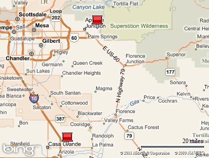
Just outside Casa Grande there are many dairy barns. We stopped at a small dairy north and east of Casa Grande about 5 miles.

As a side note if the wind blows a barnyard smell is around Palm Creek RV Park. Those on the dark side (non pet section) blame this on the dogs.

PICT0029

P2128659

Second Stop

We stopped at the Lost Dutchman Mine Museum near the Lost Dutchman State Park.

Diary Barn to Superior

There was live music and an outdoor craft fair going on the Museum grounds and lots of people.

A wall of Treasure Maps

P2128662

The Peralta Stone Maps

The stories of their discovery and what they represent are as many and as varied as the legends of the Lost Dutchman Gold Mine, itself. The two most popular versions are that the maps were discovered, and dug up, by Travis Tumlinson in 1949, on a small hill above the Fish Creek Bridge.

Another story is that they are stolen by two Mexican nationals from the basement of a church in Arispa, Mexico, and taken to Texas where they were sold to Travis Tumlinson who brought them to Arizona. Tumlinson believed they showed a route to the Peralta mines or treasure troves, in the Superstition Mountains.

P2128663

Navajo Rug Loom

P2128673

Live Music

P2128676

Cactus Garden at the Museum

P2128678

P2128681

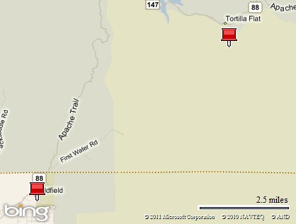
Off to Canyon Lake and Tortilla Flats

We are on the Apache Trail up from the Lost Dutchman Mine Museum to Tortilla Flats.

Map picture

Weavers Needle

P2128138

Vista on the way to Canyon Lake
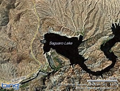
P2128686

P2128686P2128690P2128695

Canyon Lake

P2128702

P2128151

The dam responsible for Canyon Lake


P2128155P2128695

Lunch

P2128706P2128707

We ran out of time and had to turn around and go home.